System overview
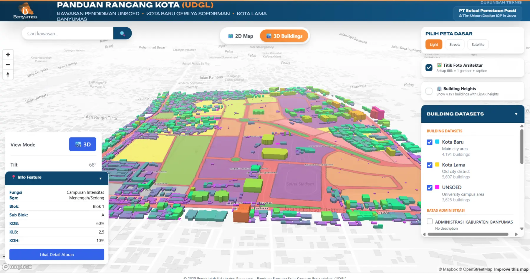
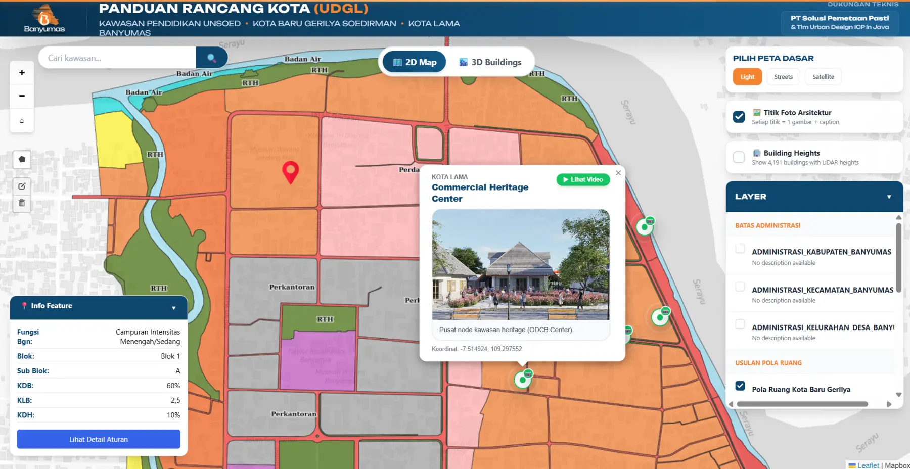
RancangKota integrates UAV LiDAR and photogrammetry, a 3D city model, development-intensity information, site identification, and a spatial-planning dashboard. The system makes detailed urban-design guidance easier to explore and apply through a single map-based interface.
Operational need
Urban-design guidance is difficult to apply when maps, intensity rules, architectural references, LiDAR-derived building information, and three-dimensional context are separated across reports and specialist files.
How the workflow operates
- Search and select a planning area
- Review land-use function, block, sub-block, KDB, KLB, and KDH information
- Open architectural reference points and supporting media
- Switch between 2D planning layers and a 3D building view
- Inspect thematic layers and building-height context
Solution architecture
- React-based map experience
- Interactive 2D mapping with planning layers
- Mapbox-based 3D building visualisation
- LiDAR-derived building-height information
- Spatial services and structured planning attributes
Core capabilities
- UAV LiDAR & photogrammetry
- 3D city model
- Development-intensity controls
- Site identification
- Planning dashboard
- Integrated city planning
Operational value
- Planning guidance becomes easier to locate and interpret
- 2D regulations and 3D urban form can be reviewed together
- Architectural references are connected to place
- Complex UDGL material becomes a usable digital product
SCALABILITY
Additional planning areas, regulations, architectural media, building datasets, and public-engagement modules can be integrated through the same spatial structure.