Project overview
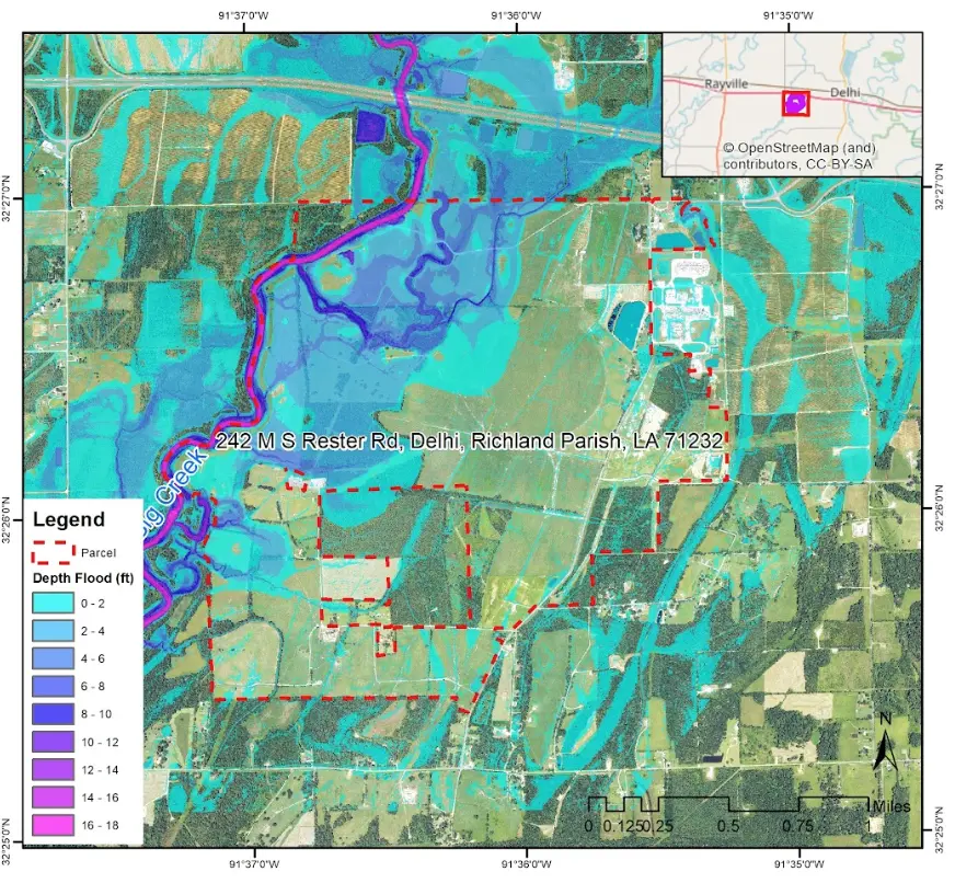
The work combines hydraulic-model outputs with GIS layers to map flood extent and hazard classes around settlements and infrastructure. The resulting visual evidence supports technical review, mitigation planning, and clearer communication with project stakeholders.
The project challenge
Hydraulic outputs must be translated into maps that show not only where water may extend, but how scenario assumptions, terrain, settlements, and infrastructure affect the interpretation of risk.
Technical approach
- Reviewed terrain, catchment, flow, boundary-condition, and scenario information available for the study.
- Prepared or interpreted hydraulic-model outputs for inundation extent and relevant hazard variables.
- Classified the mapped results into understandable depth or hazard categories where appropriate.
- Integrated settlements, roads, facilities, and study boundaries to place model results in operational context.
- Produced maps and documentation that distinguish modelled scenarios from observed flood evidence.
Key deliverables
- Flood-inundation extent
- Depth or hazard-class maps
- Exposure overlays
- GIS-ready model outputs
- Scenario map layouts and technical notes
Decision value
- Clearer identification of potentially exposed areas
- Better comparison of flood scenarios
- Map evidence for mitigation and emergency discussion
- A reusable spatial package for engineering review
QUALITY & INTERPRETATION
Model outputs are checked against terrain logic, boundary conditions, hydraulic stability, available observations, and the stated purpose of the scenario. Maps retain appropriate caveats.