Project overview
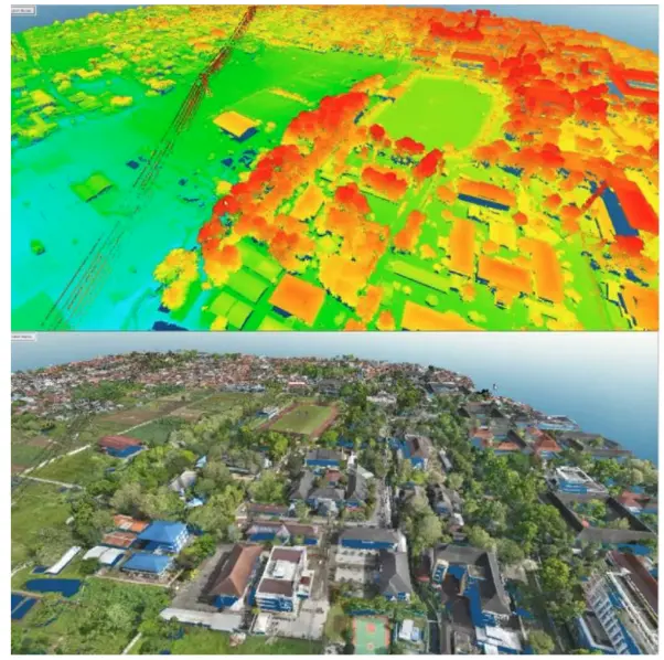
The workflow transforms raw LiDAR observations into structured, interpretable point-cloud products. Elevation and RGB views support quality control, terrain understanding, object interpretation, and preparation of downstream mapping and 3D deliverables.
The project challenge
Raw LiDAR observations are information-rich but difficult to use directly. The challenge was to structure, inspect, and visualise the cloud so that terrain, objects, elevation variation, and downstream mapping requirements could be evaluated reliably.
Technical approach
- Reviewed the point-cloud coordinate system, coverage, density, gaps, and obvious noise.
- Organised and classified points where required for terrain and object interpretation.
- Created elevation-coloured and RGB views to support complementary quality checks.
- Inspected terrain continuity, vertical anomalies, occlusion, and the relationship between the cloud and visible site features.
- Prepared the data for derived surfaces, contours, GIS layers, CAD work, or 3D presentation according to the intended use.
Key deliverables
- Structured LAS/LAZ point cloud
- Elevation and RGB visualisations
- Classification or QA notes
- Tiled and manageable data package
- Inputs for DTM, DSM, contour, CAD, or WebGIS production
Decision value
- A point cloud that can support actual mapping work
- Faster interpretation by GIS and engineering teams
- Earlier detection of gaps and artefacts
- Consistent preparation for several downstream deliverables
QUALITY & INTERPRETATION
Quality review focuses on the supplied acquisition context, control information, coordinate reference, point density, classification behaviour, and consistency between point-cloud and derived products.