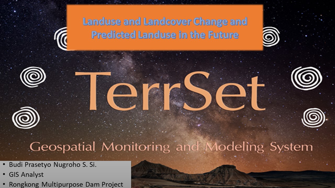
Project overview
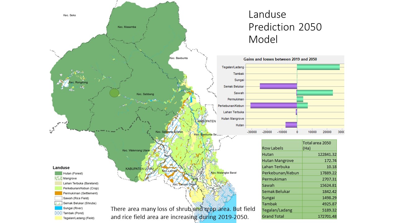
Analysis of historical land-use change and future land-use prediction for the downstream area of Rongkong Dam, using multi-temporal imagery, GIS processing, classification, and change-detection methods.
The project challenge
The downstream area of a planned dam required an understanding of historical land-use dynamics and possible future change to support engineering, environmental, and regional interpretation.
Technical approach
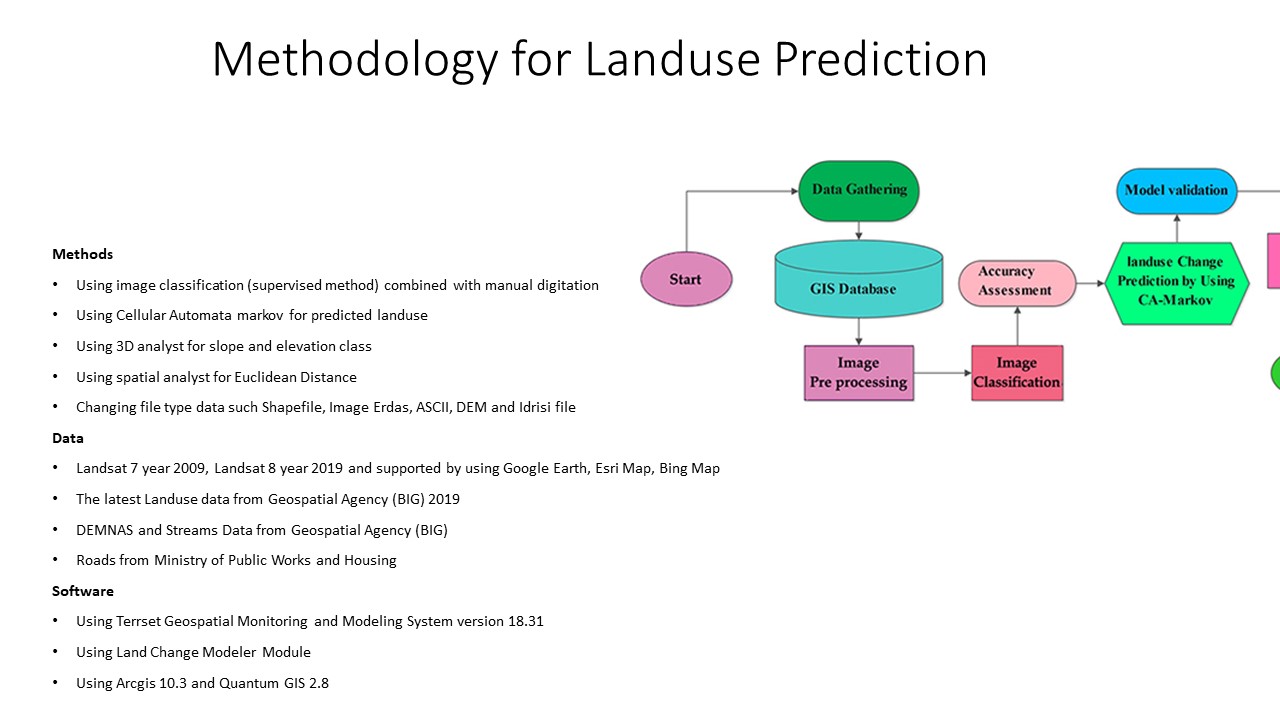
- Prepared multi-temporal imagery and a consistent classification scheme for the downstream study area.
- Mapped land-use/land-cover classes and reviewed temporal consistency.
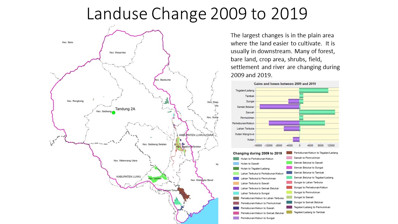
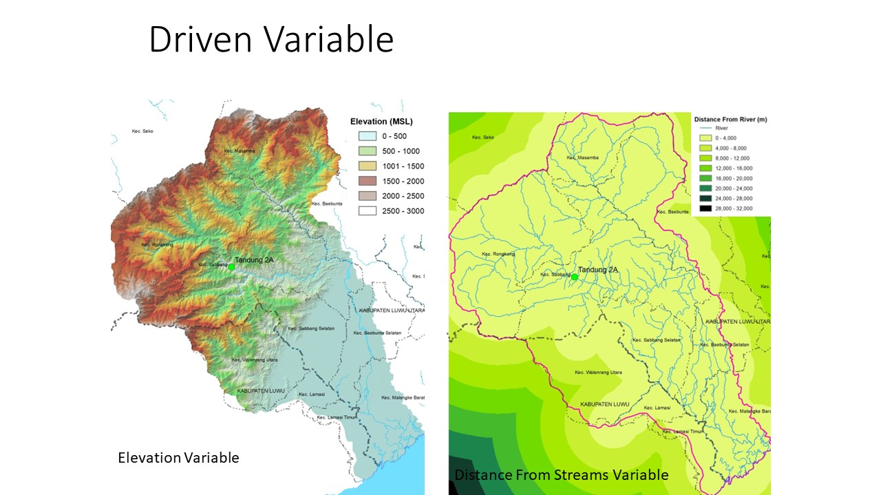
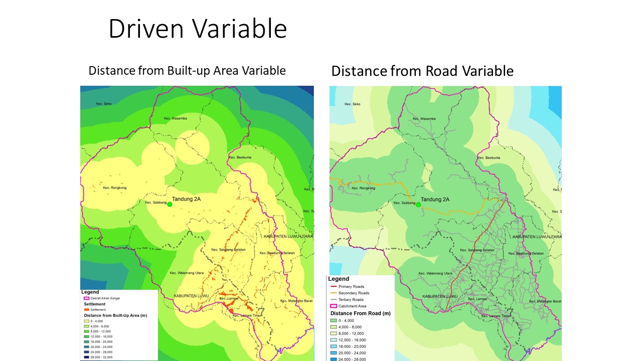
- Analysed change transitions and their spatial relationship with the river, settlements, and planned infrastructure.
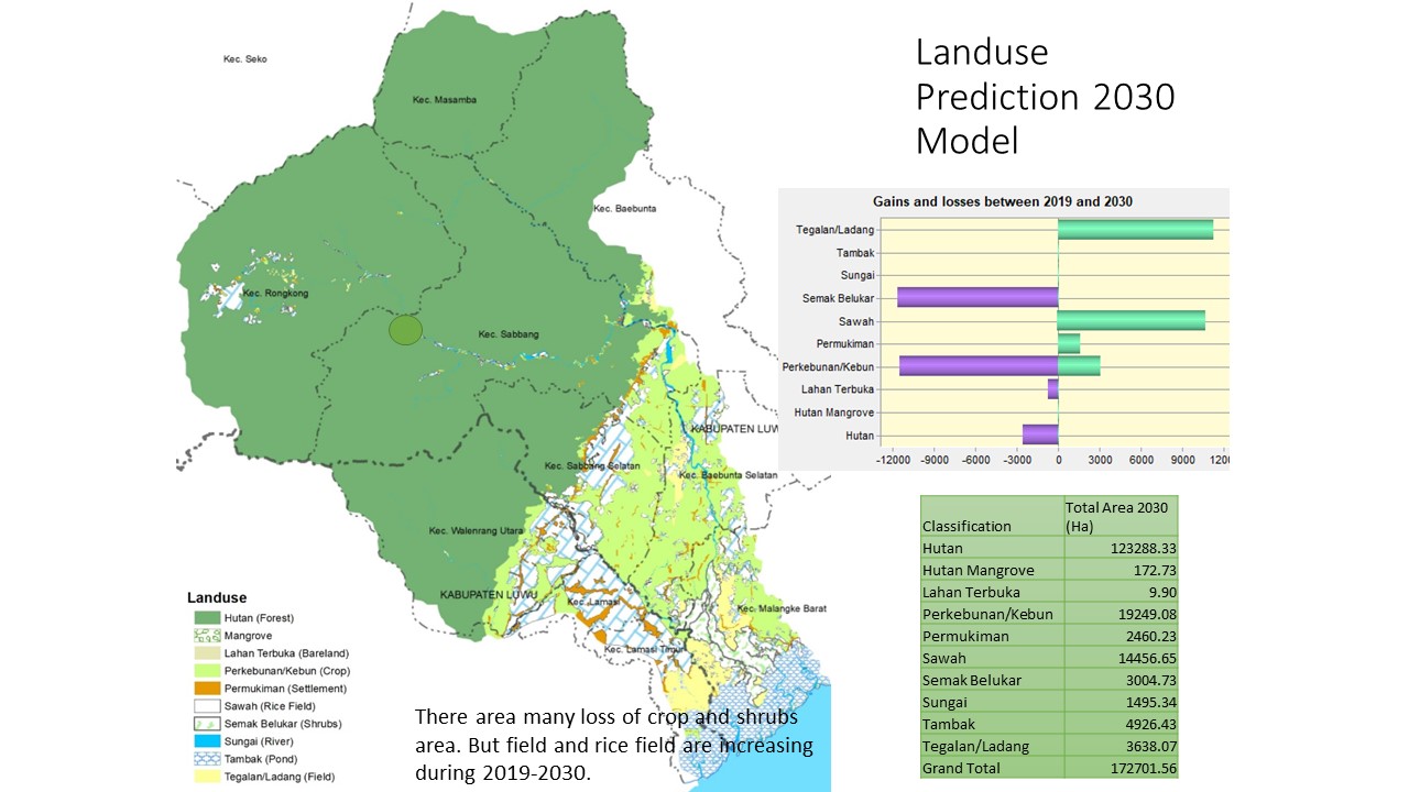
- Developed future-pattern outputs as scenarios rather than deterministic forecasts.
- Compiled maps and summaries for inclusion in project reporting and discussion.
Key deliverables
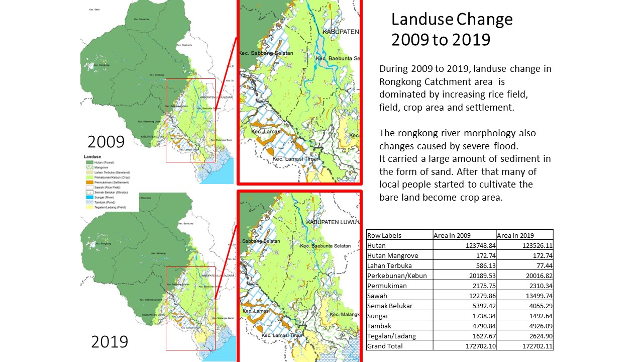
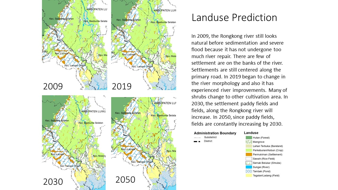
- Historical LULC maps
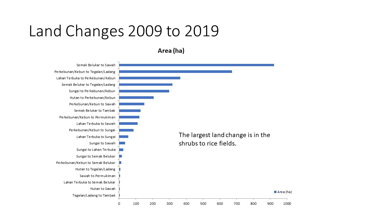
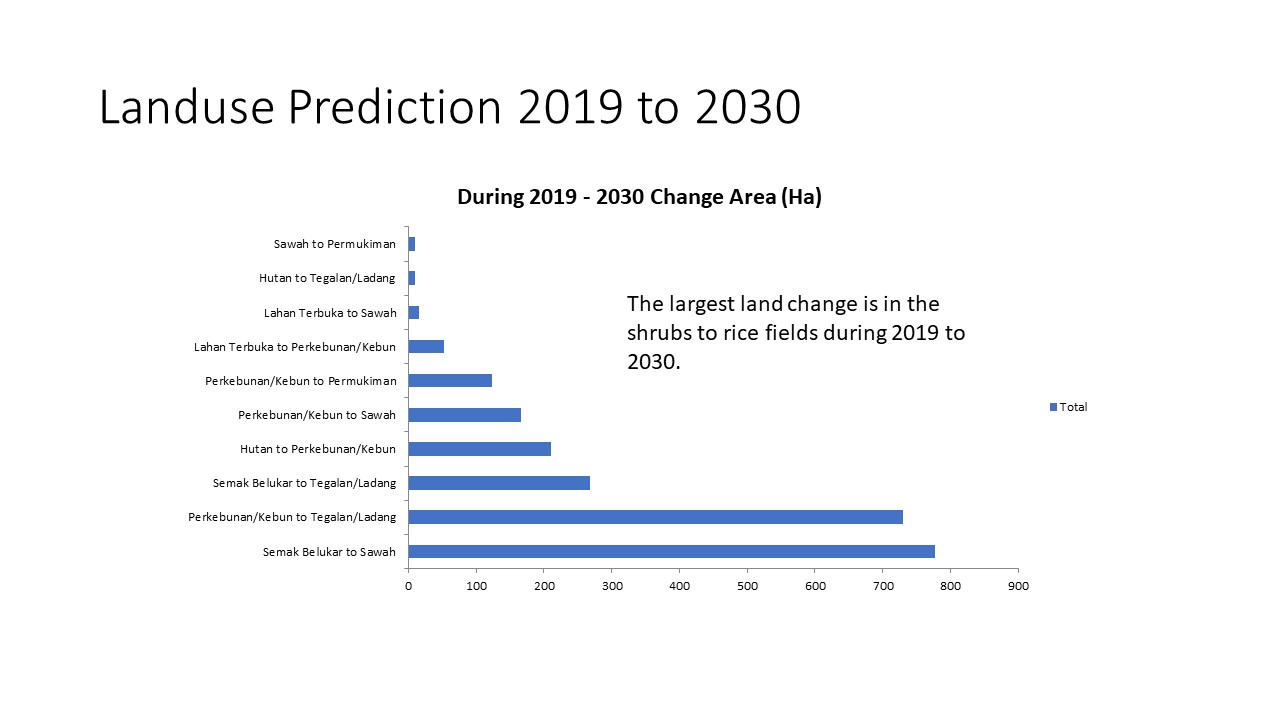
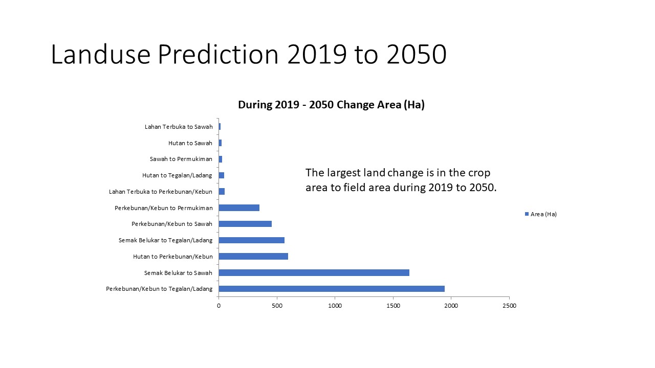
- Land-cover change analysis
- Future land-use scenario maps
- GIS-ready raster and vector files
- Technical maps for dam-project reporting
Decision value
- Environmental and planning context for downstream areas
- Identification of changing land-use pressures
- Evidence for discussing future development patterns
- A baseline that can be updated with new imagery
QUALITY & INTERPRETATION
The workflow reviews image date, classification consistency, class transitions, spatial resolution, and the uncertainty inherent in future land-use scenarios.